For law enforcement · security teams · integrators

Detection your officers can field this week.

Receivers, kits, integration and training. Delta 7 UAS is an authorized Dronetag reseller and trainer. We configure every receiver for your site, integrate it with TAK or your own platform, and train your personnel to turn a detection into evidence. Formal quotations within one business day.

Delta 7 UAS is part of Delta 7 Group, a licensed California investigation firm led by a former FBI Supervisory Special Agent. Private clients: deployments and investigations are presented on the main page.

Authorized Dronetag Reseller Equipment →

Licensed California investigation firm · CA PI Lic. No. 188424
30 minfrom arrival to receiving with the Rapid Deployment Kit
15 midetection range of a fixed receiver
25+integrations, TAK among them
0nothing transmitted. Receive-only; no license required.
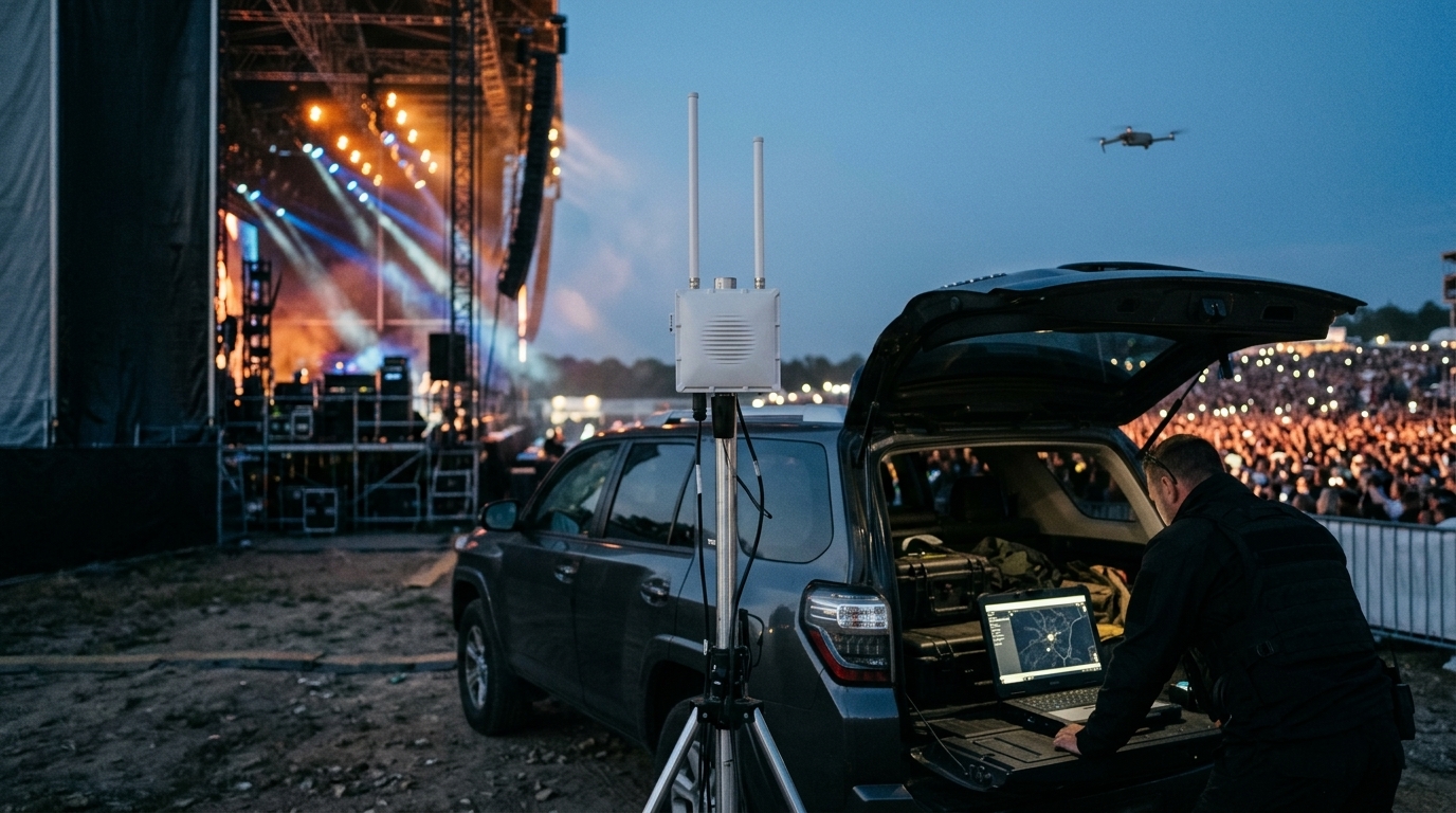
● EVENTVEHICLE-BASED SETUP · RECEIVING WITHIN 30 MINUTES
A detection receiver on a mast beside an SUV with a laptop map, behind the stage of an outdoor concert
ReceiverScout on a tripod mast
PictureDrone and pilot on your TAK map
EvidenceLogged, exportable, court-ready
When you want to buy a system

Once the threat is confirmed, we design the system, supply it and train your people to run it.

For a property under sustained attention, or an agency that needs the capability on its own trucks, we deliver a working system: the right Dronetag receiver for the site, detections flowing into the map your team already uses, and staff who know how to preserve a detection as evidence. One accountable team for hardware, software, design and training.

01 · Design

Infrastructure design

Site survey, antenna configuration by site profile, coverage plan, mounting, power and network specification. We design it; your installer or facilities team builds it; we commission it.

Design package →
02 · Supply

Dronetag receivers and kits

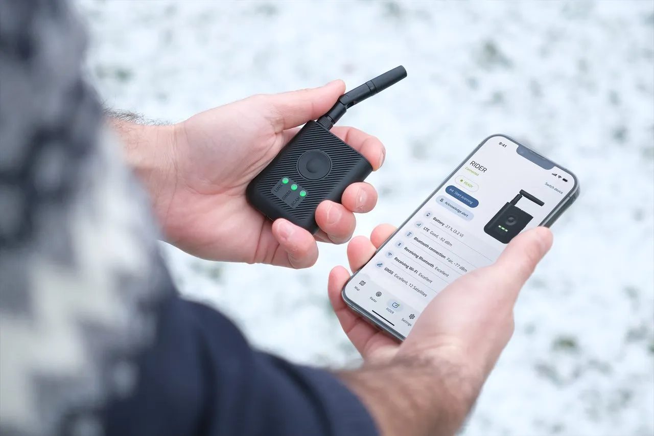
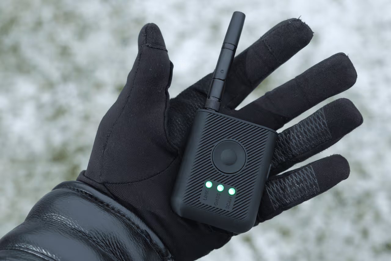
Scout (Dronetag's fixed receiver, now in its Gen 2 version) for 24/7 coverage up to 15 miles, set up in under 15 minutes: mount, PoE (power and data over one cable), antennas. RIDER (the handheld version) for the patrol car, the command post and the field. Masts, antennas and our Rapid Deployment Kit for first responders.

Equipment →
03 · Integrate

Cloud, on-premises or your own

The Dronetag App and Skyprint (Dronetag's analytics dashboard) in the cloud, a private cloud instance, a fully offline on-site server, or raw data into your counter-drone (C-UAS) platform. The drone is on a live map within seconds, the pilot's position beside it and your units on the same map; one click opens the launch point in Google Maps or pushes it to TAK, the map application law enforcement and security teams use. Alert zones and a friendly list exclude your own drones and contractors from alerts.

Integration →
04 · Train

Operator and forensics courses

Our own course: Scout and RIDER operation, retrieving and interpreting the data, preserving evidence and writing the report for the prosecutor. Every flight is logged with its track and timestamps, exportable for the case file; we teach how to preserve and present it in the Dronetag Scout Operator & Drone Evidence Course, and we teach examiners in the Drone Forensics Course.

Training →
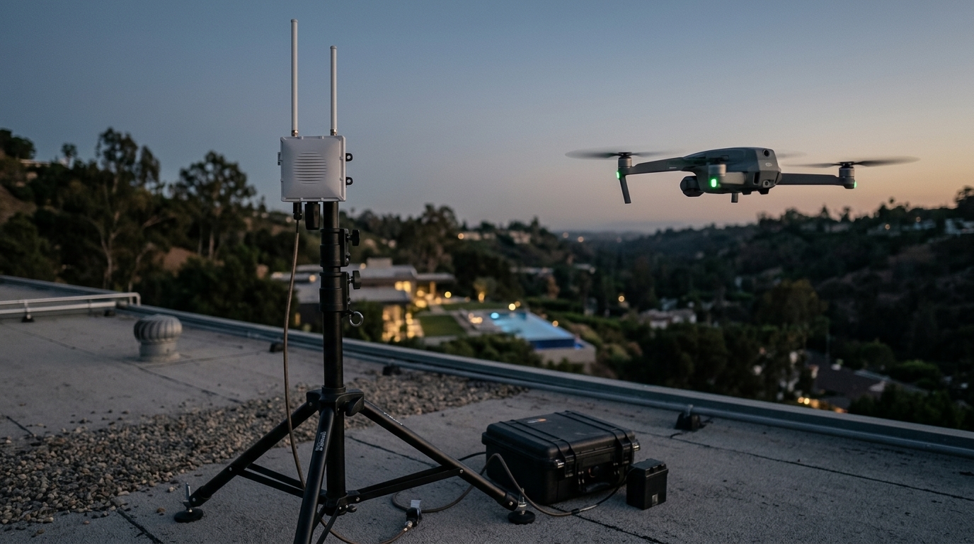
A detection receiver on a tripod mast with a hard case on a rooftop, a drone hovering nearby at dusk
Receiver, mast, case, battery. Receiving within 30 minutes of arrival.
Law enforcement · first responders

Rapid Deployment Kit

For SWAT, incident command, special events and corrections: a Scout Gen 2 on a mil-spec tripod mast with battery-powered PoE in a hard case, receiving within 30 minutes of arrival and feeding your TAK map. Configured and tested by Delta 7. Pair it with our Dronetag Scout Operator & Drone Evidence Course, priced separately, so the detection your officers make can hold up in the report and in court. Demonstration units available for agency evaluation.

Why Remote ID

The digital license plate the FAA already requires

Since March 16, 2024, every drone that must be registered in the United States (0.55 to 55 lb) must broadcast Remote ID in flight unless flown within an FAA-recognized identification area (the FAA rule follows the ASTM F3411 standard). That covers the DJI, Autel, Skydio and Parrot drones used in nearly every incident. A Remote ID receiver reads that broadcast the way an ADS-B receiver reads an airliner's position broadcast: no radar, no jamming, no emissions, no license to operate and a fraction of the cost of radio-signature or radar systems.
  • Works with all Remote ID-compliant drones, from any manufacturer.
  • Reads 2.4 GHz and 5 GHz Bluetooth and Wi-Fi broadcasts.
  • Lawful for private operators as well as agencies: receive only.
  • The broadcast carries no name. The FAA links the serial number to the registered owner, a path open to law enforcement; our investigators work the launch point in parallel.
  • Drones that do not broadcast (some under 0.55 lb, and modified drones) are outside what any Remote ID receiver can detect. We state that plainly.
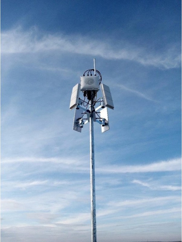
A fixed drone-detection receiver with four panel antennas on a pole against the sky
A fixed receiver with four panel antennas on a pole: the 15-mile configuration.
What the drone's broadcast contains
  • Drone serial number1581F6…
  • Drone position and altitude33.7714 N, 118.1850 W · 387 ft
  • Speed and heading20 mph · 047°
  • Pilot's position33.7701 N, 118.1937 W
  • TimestampOct 11, 2026 · 19:42:08
1122 program and grantsFormal quotations on Delta 7 Group letterhead for purchase-order, grant and 1122-program paperwork, with sole-source and reseller letters on request.
Evaluation unitsDemonstration and evaluation units for agency trials, with our team on site for the first detection.
Start smallOne Rapid Deployment Kit covers special events, incident command and corrections before any fixed installation is funded.
Training availableAdd our one-day Dronetag Scout Operator & Drone Evidence Course, priced per class, so the detection your officers make can hold up in the report and in court.
Equipment

Dronetag receivers, kits and services. Formal quotations within one business day.

Equipment is sold outright to any purchaser, public or private. Private clients who would rather have Delta 7 deploy, monitor and investigate will find those services on the main page.

Every receiver we sell leaves configured for your site, with the design, integration and training to run it; we deliver working systems, not components. Add items to a quote request and receive a formal quotation on Delta 7 Group letterhead for purchase-order, grant or 1122-program paperwork. Prices are Dronetag U.S. list prices and exclude shipping and sales tax. California sales tax applies to California deliveries, including state and local agencies; federal purchasers are exempt.

Authorized reseller
3,000+receivers deployed worldwide, the largest commercial drone-detection network
100,000+drone detections a month across that network
40+countries, including citywide networks in San Francisco and Prague
25+integrations with map, command and counter-drone platforms, TAK among them

Dronetag's founders co-wrote the technical white paper behind the Remote ID standard, and the company was selected for NATO's DIANA accelerator from 1,300 applicants. Figures from dronetag.com, October 2026.
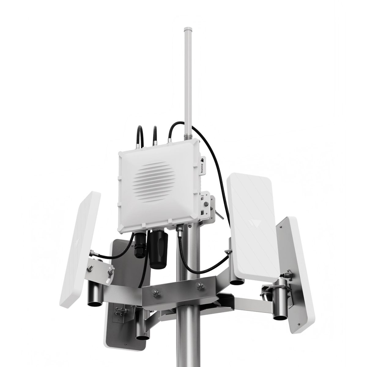
A fixed receiver with four panel antennas mounted on a pole
Scout · fixedOn a pole or roof, powered by one cable, in under 15 minutes.
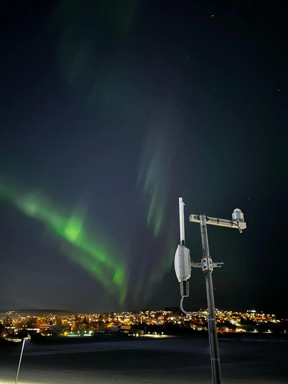
A fixed receiver on a mast at night under the northern lights
Scout · all weatherSealed and heated: −4 to 122 °F, rain, snow, 24 hours a day.
A handheld receiver held next to a phone showing a drone on a map
RIDER · handheldFits in a pocket, runs up to 10 hours and shows the drone and pilot on your phone.
A gloved hand holding a handheld receiver in winter
RIDER · anywhereVest, dashboard or hand. Ready in under a minute, no setup.
Who uses these receivers

Scout is deployed wherever a site needs to know what is flying over it, and RIDER goes wherever a person does. Dronetag reports 350+ public safety agencies, critical-infrastructure operators and armed forces using its receivers worldwide, from airports, prisons, power plants and stadiums to agencies running drone-as-first-responder programs.

  • Public safety agencies
  • Police departments
  • Fire departments
  • Search & rescue teams
  • Airports & critical infrastructure
  • Prisons & correctional facilities
  • Power plants & energy facilities
  • Stadiums & venues
  • Event security & political events
  • Environmental & wildlife protection
  • Urban planning & local government
  • Private & corporate security teams
  • Property owners & HOAs
  • Drone pilots, clubs & flight schools
Which Scout do I need?
How far do you need to see?

Omni covers up to 6 miles in every direction. 2-Sector puts sector range (up to 15 miles) in the directions that matter. 4-Sector reaches 15 miles all around and is recommended for urban areas with heavy 2.4 and 5 GHz interference.

Do you need manned aircraft too?

If ADS-B, FLARM, ADS-L, OGN or UAT matter at your site (airports, heliports, wildfire operations), choose an Aviation configuration on any antenna build.

Built for U.S. networks.

Every Scout we supply has U.S. LTE bands and is FirstNet capable (FirstNet is the public-safety cellular network; FirstNet firmware arriving in an upcoming update), so it runs on the network an agency already carries. For deployments outside the U.S., contact us. If you are unsure which build fits your site, the Delta 7 design package answers that question before you buy.

USD list · Oct 2026 · Authorized reseller
Integration & design

Detections where your team already looks.

A map on a vendor's app is a start. Agencies run on TAK, dispatch and a common operating picture; corporate security runs on its own security operations center. We integrate Dronetag data into those systems and design the physical installation that feeds them.

System integration

TargetWhat we deliver
TAKScout and RIDER tracks as CoT objects in ATAK, WinTAK and iTAK, through TAK Server or direct feed. Drone and pilot positions on the same map as your units.
Private cloudA dedicated Dronetag cloud instance for your agency or company, isolated from the shared platform, with your user accounts, retention and export rules.
On-premisesScout in On-Premise Mode on a local server, no internet connection. For facilities where detection data cannot leave the network.
C-UAS / UTMSensor Mode raw feed and the Dronetag API, MQTT and webhooks into an existing C-UAS or UTM platform. SAPIENT compatible for defense-grade pictures.
FirstNetScouts are FirstNet capable and will run on the public-safety LTE network an agency already carries once FirstNet firmware ships.
Multi-siteSeveral Scouts networked into one picture across a campus, a city or a region, with whitelists and alert zones managed centrally.

Manufacturer documentation (product sheets, user guides, operating modes, TAK setup) is provided with every quotation and at commissioning.

Infrastructure design

Design and project management only. We do not install. Our package, prepared by a former FBI Infrastructure Project Manager who directed the technical infrastructure of every capital project in the FBI's Los Angeles field office, gives your electrical contractor, IT group or facilities team everything needed to build it right the first time.

  • D1
    Site survey and threat baseline. Terrain, sightlines, RF environment, likely launch areas and a receiver survey of what is already flying.
  • D2
    Antenna configuration by site profile. Omni, 2-Sector or 4-Sector builds, or Aviation for sites with manned traffic, with sector bearings and mast height.
  • D3
    Coverage plan. Receiver count and placement for a single site, a campus or a corridor, with expected ranges by aircraft class.
  • D4
    Mounting, power and network specification. Pole, roof or mast detail, PoE+ budget, grounding and lightning protection, LTE versus wired backhaul.
  • D5
    Bill of materials and drawings. Dronetag part numbers, masts, cabling and accessories, ready for procurement and for the installer.
  • D6
    Commissioning and acceptance test. We verify the built system against the design, tune whitelists and alert zones, and hand over with the Dronetag Scout Operator & Drone Evidence Course.
Training

From a detection on a screen to a report a prosecutor can use.

Dronetag builds the receiver. Delta 7 offers two courses: the Dronetag Scout Operator & Drone Evidence Course, which turns the receiver into an investigative tool, and the Drone Forensics Course, written by Nhan Nguyen for examiners. Both are priced per class and quoted on request, and students leave with a certificate of completion.

Course 111 modules · 8 hoursPriced per classCertificate of completion

Dronetag Scout Operator & Drone Evidence Course

A one-day, eight-hour course that takes officers from seeing a drone on a screen to building a case around its pilot. It opens with a two-hour live demonstration in the field, a Scout on a mast and a DJI drone, and then covers the drone landscape, the law, the data, evidence handling, reporting and Scout operation. Two hours in the field and six in the classroom with hands-on exercises; 10 to 16 students per class. Written for sworn officers, detectives, crime analysts and digital-evidence and crime-scene personnel. No technical prerequisites.

  • First responders. Fire, search-and-rescue and drone-as-first-responder teams: know what else is in the airspace before your own aircraft launch, and document the hobby drone that grounds an air tanker.
  • Law enforcement. Patrol, special events, corrections and investigations: from alert to a Remote ID serial to a report the prosecutor can file.
  • Executive protection details. Residences, movements and venues: detect the drone over the executive, locate the pilot, and hand counsel a case instead of a screenshot.
  • Event security companies. Concerts, stadiums and private events under a TFR (a temporary no-fly zone): run the console, push the picture to the command post, and direct a response team to the launch area.
  • Licensed security operators. Guard companies and corporate security teams at campuses, ports and critical facilities: 24/7 monitoring, whitelisting your own contractors, escalation protocols.
  • MOD 1
    Live demonstration (field, 2 hours)A Scout on a mast detects a DJI drone and locates its pilot in real time. Students walk to the pilot, then watch the flight exported and hashed on the spot.
  • MOD 2
    The U.S. drone landscapeThe drone population, who flies and why it matters to your agency.
  • MOD 3
    Drone technologies and the older DJI fleetWhy older DJI drones are invisible to Remote ID receivers, and why reading them is restricted to authorized agencies.
  • MOD 4
    The lawFederal and California drone law; lawful passive reception versus restricted interception; what detection can and cannot do; who may stop a drone.
  • MOD 5
    How drones communicateEvery data element a Remote ID drone must broadcast, and what the Scout captures, stores and exports. Cloud and TAK.
  • MOD 6
    From data to evidenceExport, hash and document chain of custody. Using detection data to support legal process, from a subpoena to a search warrant affidavit.
  • MOD 7
    Two scenarios: situational awareness versus investigationTabletop exercise and contact drill: responding to the launch site and engaging the pilot.
  • MOD 8
    Export files and the structured reportHands-on: turning Scout export files into a structured drone incident report.
  • MOD 9
    The Scout, part 1: hardware, antennas and installationChoosing an antenna configuration; mounting, power and network.
  • MOD 10
    The Scout, part 2: setup, app and operationAccount setup, the Dronetag App, alert zones, whitelisting, and deploying, operating and recovering a Scout.
  • MOD 11
    Review, knowledge check and certificatesA written knowledge check and the report exercise from Module 8. Students who pass receive the eight-hour certificate.
Certificate of completion for eight hours of instruction, signed by the lead instructor and the program director. Instructors: Nhan Nguyen, M.S., Lead Instructor; Emmanuel Ladsous, Program Director. Delivered at your agency, at our Southern California training site, or as train-the-trainer for regional programs.
Course 2Examiners · investigatorsPriced per classCertificate of completion

Drone Forensics Course

For digital forensic examiners and investigators who recover a drone, a controller or a phone and need the flight history, the pilot and the media the drone captured.

  • MOD 1
    Seizure and handling of UAS evidenceAircraft, controller, batteries, SD cards and the pilot's phone. Power state, isolation and documentation.
  • MOD 2
    Flight-log acquisition and decodingOn-board logs, controller logs and app data; decoding manufacturer formats; correlating with Remote ID detections.
  • MOD 3
    Media and metadataRecovering imagery and video, geotags and timelines; proving what the camera saw and when.
  • MOD 4
    AttributionLinking the aircraft to the pilot through serials, accounts, purchase records and lawful database sources.
  • MOD 5
    Reporting and testimonyThe examiner's report, exhibits and expert declaration; cross-examination practice.
Written and taught by Nhan Nguyen, M.S., former FBI Master Digital Forensic Examiner and a current Cellebrite Master Instructor, who conducts Delta 7's drone, phone, vehicle and security-recorder examinations for litigation.
Field evidence

What receivers find when someone finally looks.

Public results from the same Dronetag receivers we deploy. No one beneath these flights had filed a complaint; the receiver was the first to know. Every figure links to its source.

Aerial view of a suburban highway interchangeOrange County, California
4,475flights by 1,371 different drones, from one receiver

A single fixed receiver at a suburban training center, October 2025 to August 2026. About 14 flights a day over one neighborhood.

Public report ↗
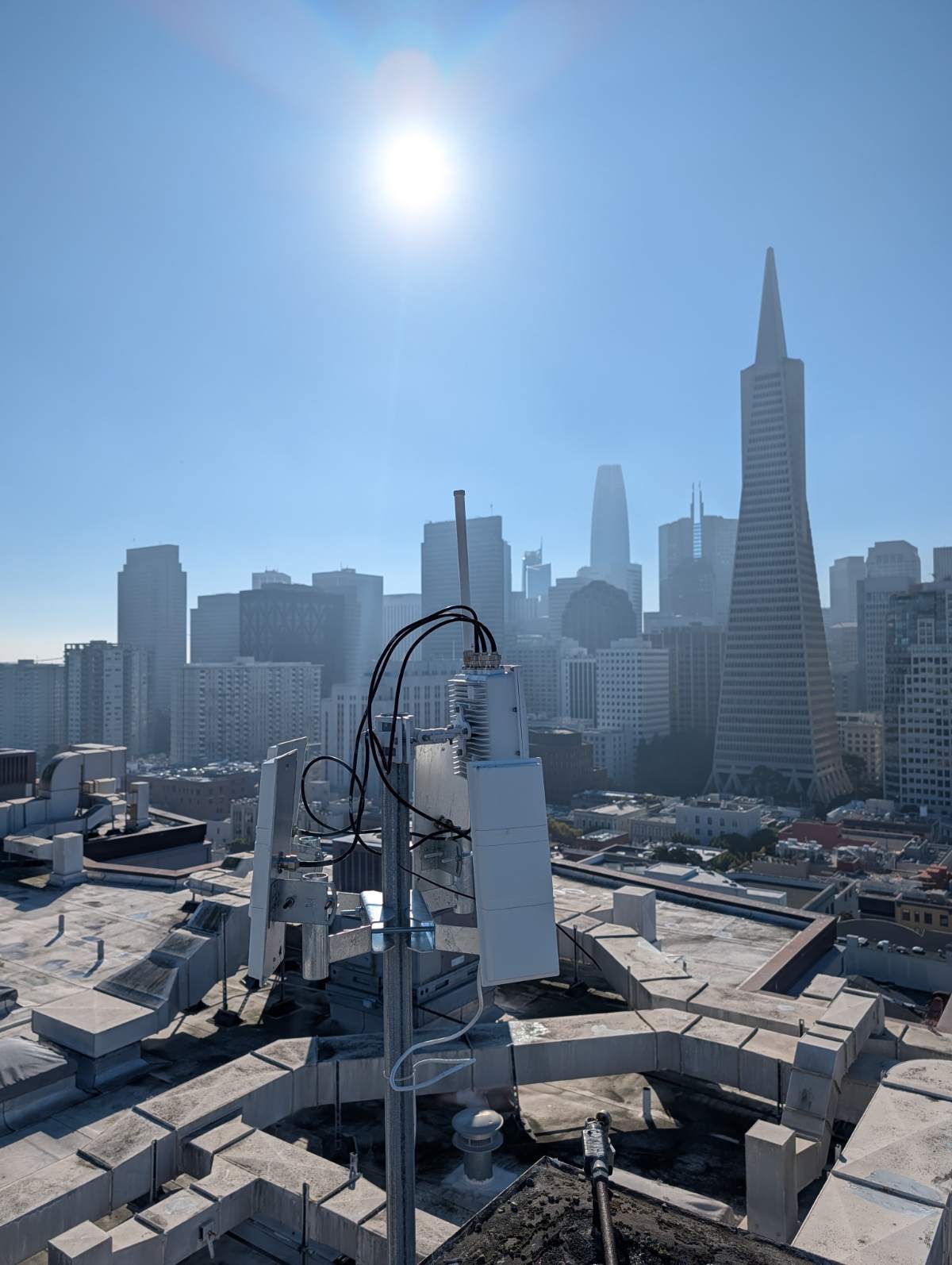
A drone-detection receiver on a San Francisco rooftop with the skyline behind itSan Francisco
5,633flights by 1,761 different drones over one city

Three rooftop receivers on Telegraph Hill, Treasure Island and SoMa, July 2025 to September 2026, every track on a map.

Public report ↗
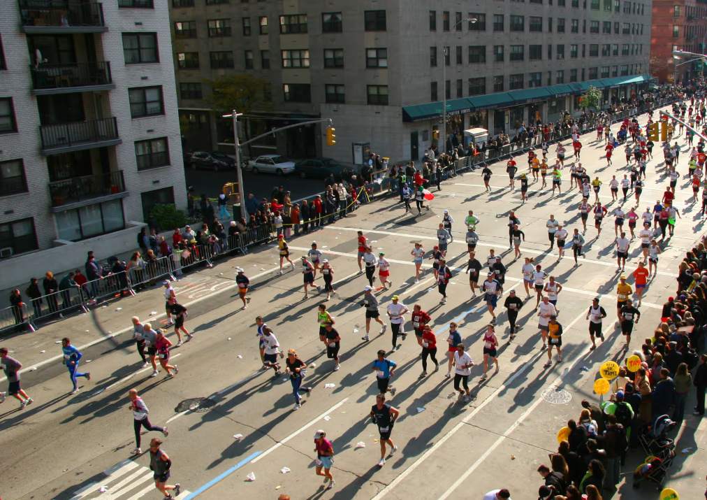
Runners and spectators on the Boston Marathon courseBoston Marathon
1 weekfrom first call to two receivers on the course

Wellesley PD was told state and federal drone support would not come. Officers were confident with the handhelds within an hour and tracked every drone over their section to 1.2 miles.

Dronetag case study ↗
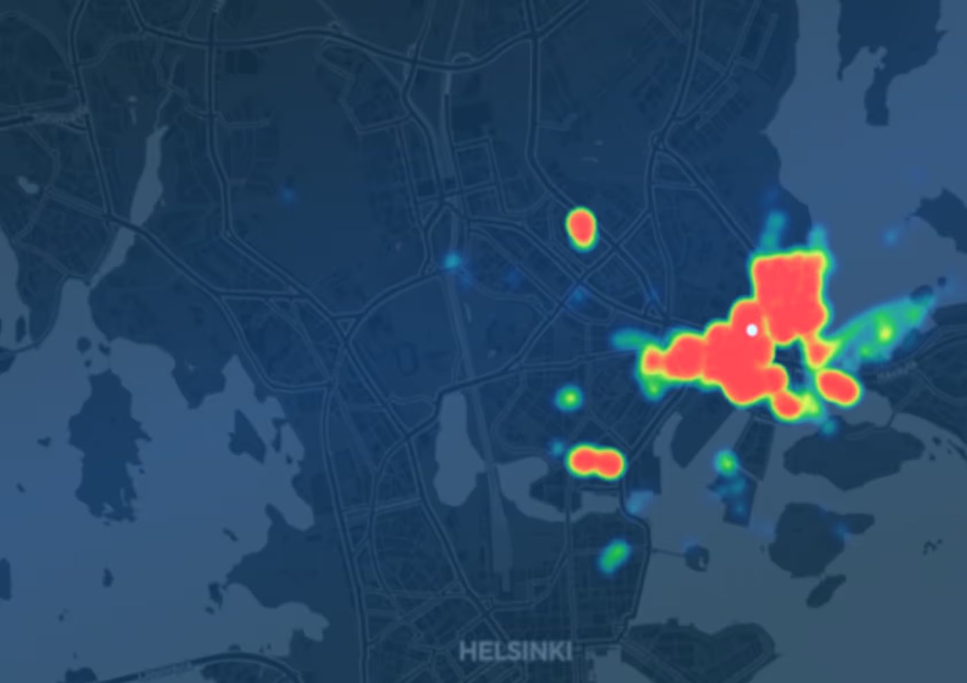
Heat map of drone flights over a cityHelsinki
87%of flights broadcast no operator ID

One receiver, one winter: 150 flights, busiest between 8 and 9 a.m., the same drones returning. The city learned where and when people fly over it.

Dronetag case study ↗

A music festival site at sunsetFestival · Netherlands
2unauthorized flights over a festival crowd, documented

Not intercepted in the air; recorded with time, track and pilot position for the organizers and law enforcement. The record is what you keep.

Dronetag case study ↗
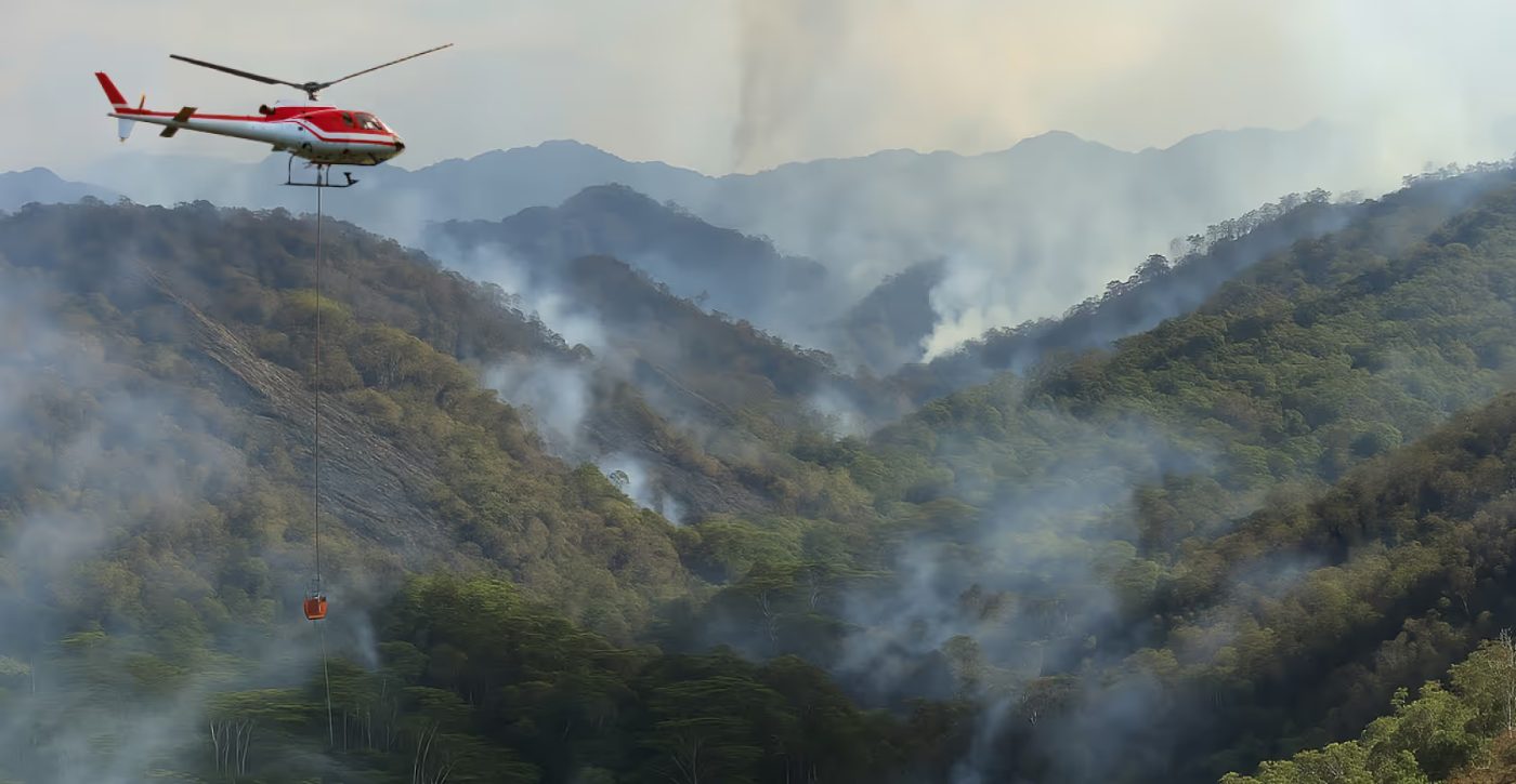
A helicopter flying over a smoking wildfireU.S. fire department
2+ mia drone picked up by a handheld receiver on a crew's vest

Hobby drones over a wildfire ground the air support. A fire department now sees what is in the air before its helicopters launch.

Dronetag case study ↗

Figures and photographs from Dronetag case studies and public Skyprint reports. These deployments were run by the agencies and operators named in the sources, not by Delta 7.

Who you are calling

We spent our careers finding people who did not want to be found.

Now we are your experts. Delta 7 UAS is led by a former FBI Supervisory Special Agent and staffed by former FBI personnel: the technical, forensic and investigative specialists who turned raw signals into evidence for decades. The receivers are made by Dronetag and are the same units law enforcement agencies use. The investigation is ours.

  • Former FBI Supervisory Special Agent24 years in the Bureau. Leads the practice and every engagement.
  • Former FBI Master Digital Forensic ExaminerCurrent Master Instructor for Cellebrite, the phone-forensics tool law enforcement laboratories use. Writes and teaches the evidence course.
  • Former FBI Infrastructure Project ManagerDirected the technical infrastructure of every capital project in the Los Angeles field office.
  • CA PI Lic. No. 188424A licensed California investigation firm and an authorized Dronetag reseller. We supply the equipment, and we also work the case.

References to FBI service describe the prior careers of our personnel.

The team

Credentialed by the agencies that wrote the playbook.

Delta 7 is led by a former FBI Supervisory Special Agent; its examiners and instructors are former FBI personnel, including technical specialists with FBI, NSA and industry certifications.

Delta 7 Group is not associated with the Federal Bureau of Investigation or any law enforcement agency. References to FBI service describe the prior careers of its personnel.

President & Founder · Program Director

Emmanuel Ladsous

24 YEARS FBI · SUPERVISORY SPECIAL AGENT · FBI/NSA-CERTIFIED TSCM (BUG SWEEP) EXAMINER · CA PI LIC. NO. 188424

Served 24 years in the FBI as a Supervisory Special Agent and certified technically trained agent, leading national security and criminal investigations spanning terrorism, counterintelligence, organized crime, public corruption and financial crime.

  • U.S. Government-trained TSCM examiner. TSCM is the detection of hidden microphones and cameras, commonly called bug sweeps.
  • Licensed California private investigator; international business and security consultant
  • Founded Delta 7's Drone Intrusion Investigations practice and the Dronetag reseller and training program
  • Member, Society of Former Special Agents of the FBI and FBI National Academy
Digital Forensics · Lead Instructor

Nhan Nguyen, M.S.

FBI 2004–2024 · CFCE · CCME · MDFE · GASF · GCFE (five digital-forensics certifications)

Former FBI Master Digital Forensic Examiner, now a Master Instructor at Cellebrite. Conducts Delta 7's phone, computer, vehicle, drone and security-recorder forensic examinations and supports litigation with expert reports.

  • Teaches Cellebrite's five-day certification courses to law enforcement examiners nationwide
  • Author and lead instructor of the Delta 7 Drone Forensics Course; lead instructor for the Dronetag Scout Operator & Drone Evidence Course
  • Develops Delta 7's evidence-preservation and export-verification procedures for Remote ID data
Director of Operations · Infrastructure Design · Instructor

Ric Swanson

FBI 1993–2021 · TECHNICAL MANAGER · INFRASTRUCTURE PROJECT MANAGER · CERTIFIED FBI INSTRUCTOR

More than 35 years of U.S. Government service, 28 with the FBI, and a concurrent private technical consulting practice of nearly 30 years. Directed the IT network, CCTV, alarm, access control, radio and cable-plant infrastructure for every capital project in the FBI's Los Angeles field office.
  • FBI Medal of Excellence for stewardship of six multimillion-dollar infrastructure projects
  • Secure communications and technical infrastructure specialist; multi-certified in advanced TSCM (bug sweeps)
  • Certified FBI instructor; co-developer of the Delta 7 Dronetag Scout Operator & Drone Evidence Course
  • Guest instructor, National Technical Investigators' Association; instructor, ISC West; presenter to UN and NYC Mayor's Office IT staff
  • Leads Delta 7's electronic security assessments, system design and project management
FBI National Academy seal
FBI National AcademyMember. The Academy's alumni network includes police chiefs and command staff from agencies across the country, many of whom are the people we deploy for and train.
Seal of the Society of Former Special Agents of the FBI
Society of Former Special Agents of the FBIMember. Our president and instructors are former FBI personnel; the investigation behind every detection is conducted to the evidentiary standard they applied for decades.
Scope and legal framework

What this equipment does, and what it does not.

Contact

Tell us what is flying over you.

Agencies, security teams and integrators: tell us the site or the mission and we will quote the receivers, the kit, the integration and the training together. Government purchasers: a W-9 and sole-source or reseller letters are provided on request.

FirmDelta 7 Group, LLC · Delta 7 UAS
Phone(800) 689-6546
Emailinfo@delta7group.com
Office4712 E. 2nd Street, Suite 231, Long Beach, CA 90803
Webwww.Delta7UAS.com · www.Delta7Group.com

All communications are strictly confidential. Government purchasers: formal quotations, a W-9 and sole-source or reseller letters are provided on request.

Your inquiry is sent to info@delta7group.com, and we respond within one business day. You may also reach us by email or telephone using the details on the left.

Call (800) 689-6546Get a quote